Disclaimer: The Hypothetical hurricane season takes place sometime in the near future. Becuase of this fact, many facts about past tropical cyclones may change to my liking (because in my fantasy world, HURDAT reanalysis has already reached past 2007). Example: You may notice Gamma being later declared two seperate tropical storms (see: Corrine).
| First storm formed | May 14 |
| Last storm dissipated | December 15 |
| Strongest storm | Hurricane Gretchen (185mph, 883hPa) |
| Total storms | TBA |
| Hurricanes | {{{hurricanes}}} |
| Major hurricanes | {{{major hurricanes}}} |
| Total damages | TBA |
| Total fatalities | TBA |
Information to go here once season is completed.
Tropical Storm Amber
| ||||
|---|---|---|---|---|
| ||||
| Duration | May 14—May 16 | |||
| Intensity | 45mph, 1010mbar | |||


A cold front moving off through the southeast spawned a thunderstorm south of Mobile Bay, Alabama. It surprisingly developed a low level center and began showing tropical characteristics. It was designated Tropical Depression One by the NHC at the 11pm ET advisory on May 14. The next morning, outflow developed around the supercell-like tropical cyclone and winds rose to 45mph. It was given the name Amber. Pressure remained higher than normal, peaking at 1010mbar. Amber struck Apalachicola, Florida at its peak on May 16, dissipating two advisories later.
Amber was a very unusual tropical cyclone, because it developed from almost a single thunderstorm and kept its supercell-like qualities throught its lifetime. Conditions in Apalachicola were similar to that of any severe thunderstorm, with breif periods of heavy rainfall, excessive cloud-to-ground lightning, and even hail in some parts. No damage nor any deaths were reported and Amber was written off as a freak occurence, barely qualifiable as a tropical cyclone.
Tropical Depression Two
| ||||
|---|---|---|---|---|
| ||||
| Duration | June 5—June 7 | |||
| Intensity | 35mph, 1003mbar | |||


On June 3rd, an unseasonable tropical wave came off the coast of Africa. It developed a low level center and resembled a tropical cyclone on June 4th, but it wasn't until early the next day when it was designated a tropical depression just west of the Cape Verde Is.
It reached its peak on its first advisory of 35mph and 1003mbar. The depression was predicted to become a tropical storm several times, but never did. It dissipated early on June 7 before reaching 35W longitude. TD-2 was the one of the farthest east a tropical cyclone ever formed in the month of June. No damage, nor any deaths were attributed to the storm, however it crossed the Cape Verde Islands as a powerful wave, spawning thunderstorms that knocked out power across the islands for a nearly 6 hours.
Hurricane Brendan
| ||||
|---|---|---|---|---|
| ||||
| Duration | June 10—June 14 | |||
| Intensity | 90mph, 989mbar | |||


Tropical Depresion Three formed quite suddenly in the southern Bahamas on June 10th. It began to move quickly towards Florida, being influenced by strong ridge to the north. Later that day, Recon confirmed that it had become the second named storm of the year. Tropical Storm Brendan, a large storm, slammed into the Ft. Lauderdale area as a 60mph tropical storm on June 11th. The storm moved back off shore into the Gulf later that day, having weakend into a 45mph storm overland.
In the Gulf, the storm slowed down regained strength. On June 12, it reached hurricane strength south of Apalachicola. Brendan continued westward, making landfall in Mobile Bay, Alabama on June 13 as a 90mph, 989mbar category one hurricane. It recurved after landfall and on June 14, it became extratropical over the Carolinas. The extratropical storm moved into New England and dissipated on June 15th over Canada.
Impact


Tropical Storm Brendan making its first landfall.
Brendan caused heavy rainfall in Florida as a large tropical storm. Over 5 inches of rain fell in the Fort Lauderdale area, and over 4 in the Miami/Dade area. Polk County recieved nearly 7 inches of rain, causing flooding in parts of Lakeland. Peace River overflowed its banks in Fort Meade. Tampa Bay recieved heavy rain as well as one reported tornado in Brendans outer bands. The tornado reached EF1 status and caused moderate damage to the Clearwater area.
The panhandle didn't receive the rain that the peninsula did, because Brendan's size had minimized over the Gulf. Wind dmage was minimal everywhere but Mobile, where several buildings were destroyed due to falling trees. Only 6 deaths were reported due to the storm, all in the Florida peninsula. Overall damage was just over $310 million in damage due to intense flooding in southern/central Florida. The name Brendan was not retired.
Hurricane Corrine
| ||||
|---|---|---|---|---|
| ||||
| Duration | June 21—July 4 | |||
| Intensity | 120mph, 960mbar | |||


A tropical wave left the coast of Africa on June 18. On the 20th, a few hundred miles east of the Lesser Antilles, it gained enough convection to be named Tropical Depression Four.
TD-4 moved westward, and was forecast to enter the Caribbean. But on June 21, on the advisory it was given the name Corrine, the forecast called for it to miss the islands completley. It, indeed, curved northwestward missing the islands to the northeast. On June 23, It formed an eye feature, and satellite data showed sustained winds of 65kt, so it was upgraded to the second hurricane of the year. At this point it was moving nearly due north. Corrine reached its initial peak as a 85mph hurricane on June 24. However, in response to an ULL over Bermuda, it turned to the northeast and weakened back to a weak tropical storm. On the 25 it began back westward along the 30N line. Sheer increased tremendosuly and convection deminished. The low level center couldn't be found and Corrine was considered dissipated later that day.
The remnant disturbance tracked back southwestward. On June 26, convection refired to the west of the system and Recon flights confirmed that somehow the highly-sheered system had become a tropical depression again. Tropical Depression Corrine entered favorable conditions the next day, restrengthing to a tropical storm. Strengthening continued and the storm reached hurricane status for a third time. A ridge to its west prevented a westward movement, and it recurved sharply. Despite this ridge, it continued to strengthen, reaching category three status on the 29th. Corrine passed well north of Bermuda (having no effect on the island due to its small size) and began to move southward again. Steering currents collapsed and it moved slowly southeastward weakening bakc to a 75mph hurricane. It drifted back to the eastnortheast on the 2nd. A small spike occured and Corrine became a category two again, but as it moved over cooler waters, the storm dissipated finally on July 4.
Impact
Due to Corrine's small size, the only effect it had on land was high surf along the coast of Bermuda.
Possibility of being two storms
Corrine was originally tracked as one storm that degenerated into a weak wave and regenerated back into a depression during its lifetime. The NHC's post storm analysis revealed that Corrine may have actually dissipated on the 25th at the same time another disturbance directly west of it was forming. The second disturbance gained enough organization to be considered a tropical depression the next day. At one point, one could even track two seperate low level centers. The NHC decided to keep it one storm, but this may be changed at a later date.
If the best track data of the storm is changed to have indeed been two seperate storms, they would be called Corrine1 and Corrine2. It would also mark the first time 5 tropical cyclones formed before July in Atlantic history. Additionally, it would be the first time a storm has been declared two seperate systems since Tropical Storm Gamma (2005), which was later found to be two individual tropical storms several years after it occured.
Tropical Depressions Five and Six
| ||||
|---|---|---|---|---|
| ||||
| Duration | July 7—July 8 (TD-6), July 9 (TD-5) | |||
| Intensity | 35mph, 1006mbar | |||


Three small surface lows located very near each other in the central Atlantic both began gaining organization in early July. At the same advisory on July 7, two of them were upgraded to tropical depressions, while the other dissipated. The depression further southwest was designated Tropical Depression 5 and the one to the northeast was called Tropical Depression 6. TD-6 eventually lost its definition and dissipated the next day, while TD-5 continued to meander until the 9th. No damage nor any deaths were contributed to either storm.
The NHC's biggest dillema of the season occured when these two tropical depressions formed at exactly the same time, in nearly the same place, in nearly the same way, and looked fairly similar through most of their lifetimes. Due to the uncertainty of which storm formed first, the NHC gave the closest depression the number 5 and the further, 6. The confusion between storms was only increased when re-analysis showed that TD-6 may have been a depression before TD-5. Both of them peaked at exactly 35mph and 1006mbar. The NHC just decided to put both depressions in one single TCR.
Later, the NHC found that there was a possibility that neither of them were truly tropical, and they could have avoided this mess all together.
Tropical Storm Dominick
| ||||
|---|---|---|---|---|
| ||||
| Duration | July 17—July 19 | |||
| Intensity | 70mph, 1005mbar | |||


On July 15th, a tropical low developed in the Bay of Campeche. It stayed relatively stationary, while convection increased. Recon found a closed low and surface winds of 45kts on July 17th. The storm was immediately upgraded to a tropical storm. Pessure was still very high, at only 1005mbar, but the storm was allowed to strengthen to 70mph before making landfall in Campeche, Mexico on the 19th. Damage was extremely minimal, and Dominick dissipated quickly. Some meteorologists say that a weak surface low remained intact and traveled west over the Caribbean and southern Florida, reforming into Tropical Depression 9 over the Bahamas. However, that has yet to be confirmed.


"Tornado Dominick", taken on July 20th, 4:17 pm EDT
Thunderstorms in southern/central Florida from the remnants of Dominick spawned an EF-2 tornado that spun northward up half of the state. It was first spotted near the Everglades, and radar was able to track the tornado all the way up to northern Polk county, over 3 hours later. It was an EF-2 only breifly in a sparsely populated area. Damage from the tornado was minimal, and no one was injured, but it was notable for its extreme duration. It's also abnormal because it traveled almost directly north, which is strange for a tornado. It is currently, by far the most well documented tornado in Florida history, with over 210 home and professional videos reported to the NWS. It is sometimes referred to as "Tornado Dominick".
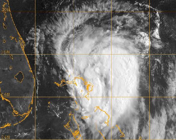
Hurricane Elizabeth
| ||||
|---|---|---|---|---|
| ||||
| Duration | July 21—August 1 | |||
| Intensity | 180mph, 907mbar | |||


On July 21st, a large area of disturbed weather developed enough of a closed circulation to be named Tropical Depression Eight on July 21st inbetween the Lesser Antilles and the Cape Verde Islands. It moved at a spedy rate westward, disorganized, and difficult to track. Two days later, the depression slowed down, and began a northwestward crawl near the Leeward Is. This drop in speed allowed the convection to consolidate near the center, and it was finally named Tropical Storm Elizabeth. Steering currents weakened, and the storm became stationary on the 24th. Elizabeth began a more westward crawl that night, passing south of Puerto Rico as a 55mph tropical storm early the next morning. It continued slowly westward, being downgraded back to a tropical depression that day as it interacted with Southern Hispaniola. Elizabeth then moved west-southwest away from the Greater Antilles on 26th, regaining its Tropical Storm status.
Then Elizabeth hit a period of super rapid inensification. Recon reported the beginning of the deepening on the 27th, at 5:00pm EDT, south of Jamaica, when pressure fell from 1003mbar at 11:00am EDT that morning to 992mbar in only 6 hours, and winds had strengthened to nearly 80kts. and Tropical Storm Elizabeth was upgraded to a high end category 1 hurricane. It developed a 6-8 mile pinhole eye.
Pressure then began to fall phenomenally fast. By 11:00 that night, pressure had fallen from 992mbar to 965mbar, bringing it to a category three hurricane. Within 6 more hours, it was upgraded to a category 4, with pressure of 940mbar. In the 6 hours following, pressure levelled out at 914mbar, and Elizabeth was now a small, but powerful category five. In 24 hours, Elizabeth deepened from 1003mbar to 914mbar, a drop of 89mbar. Winds were now up to 165mph. Elizabeth spent the rest of the day as a category five, and the most of the 29th as a category five. At 11:00pm July 29th, Elizabeth weakened back to a category 4. It was now passing through the Yucantan Channel. Early on the 30th, it reached a point north of the Yucatan. Pressure again fell. Elizabeth restrengthened to a category five, with a peak pressure of 907mbar, and peak winds of 180mph. Suddenly, an eyewall replacement cycle took over, and pressure rose significantly. Elizabeth weakened back to a category three hurricane, and made landfall south of Corpus Christi, Texas on July 31st. The small storm would dissipate over northern Mexico on August 1st.
Elizabeth set the record for the strongest Atlantic hurricane ever in the month of July.
Damage
(will expand a GREAT deal in the future) Damage from Elizabeth could have been a lot worse, but it was still severe. Nearly $6 billion in damages were reported overall, $4.6 billion occuring in Texas. Central America reported $700 million in damage, Mexico reported $300 million, and Puerto Rico reported $250 million in damages. 11 fatalities occured, 8 in Honduras and 3 in Texas. The damage from Elizabeth was enough to retire the storm.
Tropical Depression Nine
| ||||
|---|---|---|---|---|
| ||||
| Duration | July 22—July 24 | |||
| Intensity | 35mph, 1000mbar | |||

Tropical Depression Nine developed out of a nontropical low that fused with the remnants of Dominick. It formed off the coast of Florida on July 22 and moved westward. It had deep convection for most of its life, and pressures at its peak were 1000mbar. Officially, winds never rose above 35mph, but unofficial reports of tropical storm force winds were recovered. The tropical depression meandered a while until dissipating on July 24. Heavy rain was reported in the Bahamas, but no major damage, nor any deaths occured.
Some forecasters link the formation of TD-9 as a direct continuation of Dominick. This would have made it Tropical Depression Dominick. It is very possible that the two were one in the same, but it's worth noting that many global and tropical models predicted the formation of this tropical cyclone long before they developed Dominick, which would indicate the two systems were seperate.
It's also worth noting that for several hours near the beginning of its life, the system was called 09L.FORD. This is due to recon reporting 35kt sustained winds in the northeast quadrant. As the NHC was planning to upgrade it, another pass through the center only recovered winds of 16kts, and the upgrade was put off. TD-9 never strengthened further. Many meteorologists believe this should have been given a name, whether it be Dominick or Ford.
Hurricane Ford
| ||||
|---|---|---|---|---|
| ||||
| Duration | August 28—August 30 | |||
| Intensity | 85mph, 988mbar | |||


After a record setting June and July, an unusual lull occured in August. Nearly a full month after Elizabeth dissipated on the first, a non-tropical low organized into the only numbered depression of the enitre month. Subtropical Depression 10 was initiated on August 28th, in the central Atlantic. The subtropical depression was predicted to dissipate, but in the six hours between its second advisory and its third advisory, it became tropical, and it strengthened into a hurricane. Meteorologists were astonished, never in history had a subtropical depression been upgraded into a tropical hurricane anywhere near that fast. Hurricane Ford moved to the northeast at a rapid pace of nearly 43mph. Peaking at 988mbar and 85mph, the hurricane began to weaken and became a tropical storm on the 29th. It became extratropical on the 30th, getting absorbed by a larger low.
Subtropical Storm Gretchen
| ||||
|---|---|---|---|---|
| ||||
| Duration | September 3—September 6 | |||
| Intensity | 50mph, 999mbar | |||


A large area of low pressure developed over the southern Gulf of Mexico in late August. It drifted northward, remaining highly sheered and disorganized. However, right before landfall, the system suddenly became better organized. The NHC issued a Special Tropical Disturbance Statement saying that the storm was able to produce squally winds and heavy rain, but was an extratropical low. On September 2, the center moved inland, but continued to show more and more tropical characteristics. Early on September 3, the NHC issued the first advisory on Subtropical Depression 11. As the storm moved further inland, it surprisingly reached winds of 40mph, and became Subtropical Storm Gretchen. The storm hit a peak of 50mph before weakening back into a subtropical depression. It curved back to the southeast, moving back over water. Convection remained well seperated from the center, but the storm was still able to strengthen back to a 45mph subtropical storm before making landfall south of New Orleans on September 6th. It became extratropical later that day.